Lake Rutundu
About This Destination
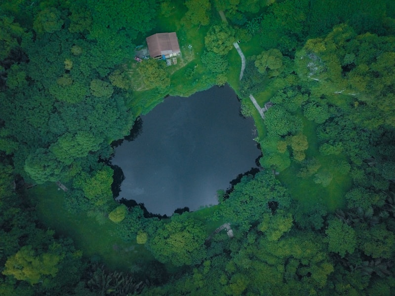
Lake Rutundu sits at an elevation of 3,078m on the northern slopes of Mount Kenya. The lake is surrounded by moorland vegetation and offers a unique high-altitude experience with opportunities for fishing, hiking, and wildlife spotting.
What to Expect
Expect cold temperatures, thin air at high altitude, and pristine wilderness. Bring warm layers and rain gear.
Nairobi to Nanyuki to Rutundu
scenic drive from Nairobi to Marania Forest Station, the main entry point for Lake Rutundu.
Route Waypoints
Nairobi Start
-1.2864, 36.8172
Nanyuki Town
0.0097, 37.0731
Rutundu Camp
-0.0416, 37.4565
Highlights
Nairobi to Meru to Rutundu
scenic drive from Nairobi to Marania Forest Station, the main entry point for Lake Rutundu.
Route Waypoints
Nairobi Start
-1.2864, 36.8172
Embu Town
-0.5370, 37.4510
Meru Town
0.0569, 37.6402
Rutundu Camp
-0.0416, 37.4565
Highlights
Lake Rutundu Extended Circuit
Large perimeter circuit around Lake Rutundu covering surrounding moorland ridges and viewpoints roughly three times the lake's footprint.
Route Waypoints
North Shore Ridge
-0.0409, 37.4662
Northern Moorland
-0.0397, 37.4681
High Alpine Bend
-0.0386, 37.4694
North-East Ridge
-0.0378, 37.4676
Moorland Overlook
-0.0374, 37.4651
Eastern Plateau
-0.0376, 37.4628
East Descent
-0.0385, 37.4609
Heather Basin
-0.0396, 37.4594
South-East Turn
-0.0408, 37.4585
Southern Moorland
-0.0421, 37.4581
South Ridge
-0.0435, 37.4587
Glacial Hollow
-0.0446, 37.4599
South-West View
-0.0453, 37.4615
Western Valley Edge
-0.0455, 37.4636
West Ridge
-0.0451, 37.4657
Moorland Saddle
-0.0442, 37.4676
North-West Ridge
-0.0431, 37.4686
Cabin Return Ridge
-0.0422, 37.4673
North Shore Ridge
-0.0409, 37.4662